Progress in the use of UAS Techniques for Environmental Monitoring
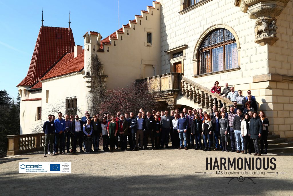
Workshop was held at the Institute of Botany of the Czech Academy of Sciences, Průhonice, Czech Republic, during 27th February to 1st March 2019 as a part of COST Action CA16219 HARMONIOUS – Harmonization of UAS techniques for agricultural and natural ecosystems monitoring. It was very succesful and productive, we had 99 participants from 30 countries. Thanks you all for comming!

Programme
- Wednesday 27 February (9 am to 5:45 pm; from 7 pm – optional social gathering in the Prague Center) – Workshop with COST Action Lectures and invited speakers (registration is closed)
+ practical sessions – MicMac (E. Rupnic); Advanced processing in Agisoft Photoscan (J. Šedina, G4D) - Thursday 28 February – Working Groups meetings with cross interaction between WGs (9am to 5:45 pm) – 5 parallel sessions (reserved for COST HARMONIOUS members only)
- Friday 1 March (9 am to 1 pm) – Management Committee and Summary of the Activities of WGs (reserved for COST HARMONIOUS members only)
PRACTICAL INFORMATION ABOUT THE VENUE
Workshop 27. 2 2019
(registration is closed)
8:30 – 9:00 – Registration
9:00 – 9:15 – Welcome and Introduction
9:15 – 9:30 – HARMONIOUS Activities – S. Manfreda, B. Toth
1st session -Vegetation Monitoring
9:30 – 9:45 – Timing and scale matters: unmanned aircraft vs. satellite imagery in plant invasion monitoring – J. Müllerová, T. Bartaloš, J. Brůna, P. Dvořák, M. Vítková
9:45 – 10:00 – Woody vegetation monitoring combining high-resolution multi-spectral UAV imagery – a case study from a sub-arid region in Israel, R. Kent, H. Dan, I. Shapira, A. Perlberg and I. Levinsky:
10:00 – 10:15 – Does BRDF information from overlapping UAV images improve grassland yield mapping in northern Norway? – C. Davids and M. Jørgensen
10:15 – 10:30 – Estimation crop physical parameters from UAV RGB imagery and deep learning – M. Polinova, K. Salinas and A. Brook
10:30 – 10:45 – DRONE AND SENTINEL-2 Data application for mapping of mowing effects on reed stands in the Plateliai lake (Lithuania) – M. Bučas, E. Tiškus and V. Stragauskaitė
10:45 – 11:00 – Evaluating Remote indices from unmanned aerial vehicles (UAV) on European marginal land – F. Gnädinger, M. Obermeier and P. Schröder
11:00 – 11:30 – Coffee Break
2nd Session Water Monitoring
11:30 – 11:45 FISHSTREAM: Determining Surface Velocity Fields near Fish Passages at Hydropower Dams – D. Strelnikova, G. Paulus, K.-H. Anders, P. Mayr, S. Kaefer, H. Mader and R. Schneeberger
11:45 – 12:00 Empirical Comparison of Shallow Water Bathymetry Data – UAS MultiView Stereo Photogrammetry versus Single Beam Echo Sounding – G. Paulus, K.-H. Anders and M. Erlacher
12:15 – 12:30 Field applications of infrared thermography: estimation of hydrological and hydraulic variables – J. de Lima, J. M. Gonçalves and I. de Lima
12:30 – 12:45 UAV monitoring of fluvial dynamics of the montane streams – J. Langhammer and T. Lendzioch
12:45-14:00 Poster session, Lunch, Commercial presentations
Poster Session:
- Crowdsourcing and UAS help to fight plant invasions – J. Brůna, J. Janák, J. Müllerová, T. Bartaloš, P. Dvořák, M. Vítková
- Innovative integration of UAV and geophysics techniques for monitoring Natural Arches in Malta and Gozo: the case study of Wied Il-Mielah (Gozo) – E. Colica, S. D’Amico, S. Martino, R. Iannucci, A. Paciello and P. Galea:
- Forest microclimate and its modelling with remote sensing – V. Kašpar, L. Hederová, M. Kopecký, M. Macek, J. Müllerová and J. Wild
- A method for up-scaling the assessed soil ecological functional state with the use of UAS data – M. Tsiafouli, M. Papadopoulou, A. Tsavdaridou, B. Marteinsdóttir and S. Sgardelis
3th Session Morphological and Soil Monitoring
14:00-14:30 Accuracy estimation and optimization of UAV photogrammetric 3D models – selected real case-studies realized with the free open source photogrammetric suite “MicMac” – E. Rupnik (invited)
14:30-15:00 Photogrammetric considerations for SfM-based topographic modelling – M. James (invited)
15:00-15:15 Spatio-temporal data fusion for monitoring terrain of olive plantations in the South of Spain – J. M. Jurado Rodríguez, L. Martínez Cartas and F. Feito
15:15-15:30 Thermal emission of soil surfaces assessed from temperature data recorded by UAV-thermal sensors – E. Schmaltz and P. Strauss
15:30 – 15:45 – Coffee Break, Posters, Commercial Communication
15:45 – 17:45 – SfM Training
Processing with MicMac – E. Rupnic
Advanced processing in Agisoft Photoscan – J. Šedina, G4D
From 19:00 – Social gathering at the city center – Pub U Šumavy (optional, at your own expense) – see, where it is
Special Issues
The best oral presentations will be selected for publication on one of the two Special Issues:
1) Progress on the Use of UAS Techniques for Environmental Monitoring on Remote Sensing (MDPI, IF 3.406)
2) Hydrological and Environmental Modeling: From Observations to Predictions on Water (MDPI, IF 2.069)
Venue
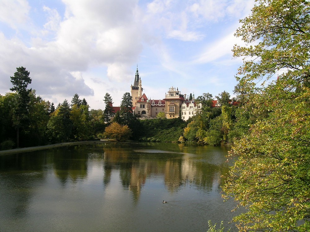
The workshop will be held at the premises of Institute of Botany in the Průhonice castle. Conference hall is actually beautifully restored Knight’s hall of the castle.
Průhonice are located at the outskirt of Prague. Průhonice castle and surrounding park are designated as Czech National Historic Landmark and a UNESCO World Heritage site.
The venue is served by Prague public transport. How to find us
PRACTICAL INFORMATION ABOUT THE VENUE
Organizing comittee
Jana Mullerová (Institute of Botany, Czech Republic)
Salvatore Manfreda (Università degli Studi della Basilicata, Italy)
Petr Dvořák (Brno University of Technology, Czech Republic)
Josef Brůna (Institute of Botany, Czech Republic)
We thank to our sponsor: